
📍 Buenos Aires
Buenos Aires
Testing smarter, cleaner and more inclusive ways to move people and goods through one of Latin America's busiest cities
Buenos Aires is testing practical tools that help optimise last-mile logistics, improve the use of loading and unloading spaces, and transform mobility data into evidence-based public policy.
Buenos Aires at a glance
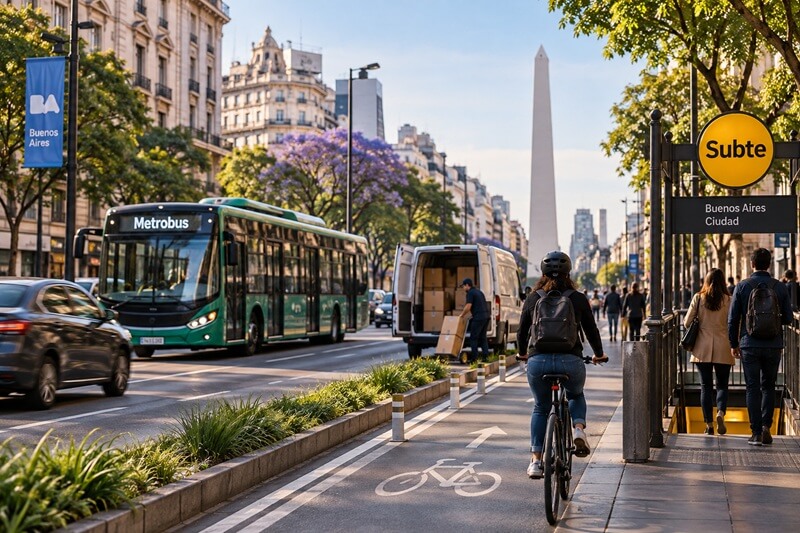
The City of Buenos Aires sits at the centre of one of Latin America's largest metropolitan areas. Its transport system connects buses, metro, rail, walking, cycling and shared mobility through a dense and active urban network. The city has already advanced important mobility innovations, including Metrobus corridors, the Ecobici bike-sharing system, digital ticketing through SUBE, and data tools for mobility analysis.
At the same time, Buenos Aires faces persistent congestion, fragmented metropolitan governance, rising e-commerce deliveries and growing pressure on urban logistics. Transport is a major source of greenhouse gas emissions, making digitalisation an important pathway for cleaner mobility, better planning and more efficient operations.
Why Buenos Aires?
A strong foundation for digital mobility
Buenos Aires offers a strong foundation for ACCESS because it combines existing digital mobility assets with urgent implementation needs. The city has experience with public transport data, smart mobility services and sustainable mobility planning, while also facing real operational challenges in last-mile logistics, loading space management and inclusive transport policy.
The ACCESS pilot package focuses on turning data into action. It supports cleaner freight operations, smarter use of curb space, and better public policy through mobility analytics. Together, these pilots demonstrate how digital tools can help cities move from isolated data sources to practical decisions that reduce emissions and improve everyday mobility.
Three pilots for smarter urban mobility
01
Aboutthe pilot
Courier fleet tracking and dynamic routing
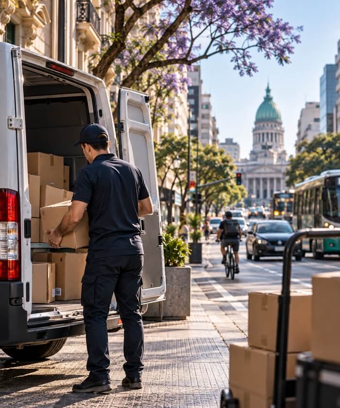
Buenos Aires is growing more reliant on e-commerce, and that means more delivery vehicles navigating the city's dense traffic. This pilot introduces a dynamic routing and fleet tracking tool that helps drivers optimise delivery routes in real time. The technology adapts to changing traffic, demand, and vehicle availability. Focused on key commercial areas with high logistics demand, the pilot integrates carbon emissions calculations directly into last-mile delivery operations, addressing a need identified together with local stakeholders for more efficient, sustainable logistics.
The tool combines a mobile app for drivers with a dashboard for data analytics, built to integrate with services already in use. Express Logística and other logistics companies will apply the system's real-time route optimisation and emissions calculation features across selected commercial zones, with the pilot's success measured by the platform's reliability, ease of use, and its impact on delivery times, fuel consumption, and GHG emissions.
02
At a glance
Challenge
Optimise delivery routes in real time to reduce distances, delays, fuel use and emissions.
Solution
Dynamic routing, fleet tracking and emissions calculations integrated into existing services.
Technology
Mobile app for drivers and an operator dashboard with real-time analytics.
Avoid
Reduce emissions and fuel consumption by improving routes and avoid additional trips by improving cargo distribution, efficiency and delivery scheduling.
Shift
Promote modal shifts by facilitating data-driven insights on GHG emissions and cost savings associated with shifting to low-emission vehicles for last mile deliveries.
Improve
Enhance the efficiency by developing a transport management system and showcasing the benefits of greener practices.
03
Expectedoutcomes
Environmental
Reduced GHG emissions and fuel consumption due to dynamic routing.
Social
Enhanced inclusivity of urban logistics workforce and training promoting the inclusion of women in logistics operations.
Economic & Operational
Increased number of deliveries completed through reduced journey times and kilometers traveled.
Digital & Innovation
Consistent use of developed tools by logistics operators.
Governance / Institutional Frameworks
Established frameworks for scale-up and institutionalisation of best practice and lessons learnt.
02
Aboutthe pilot
Digital tool for parking management of urban logistics
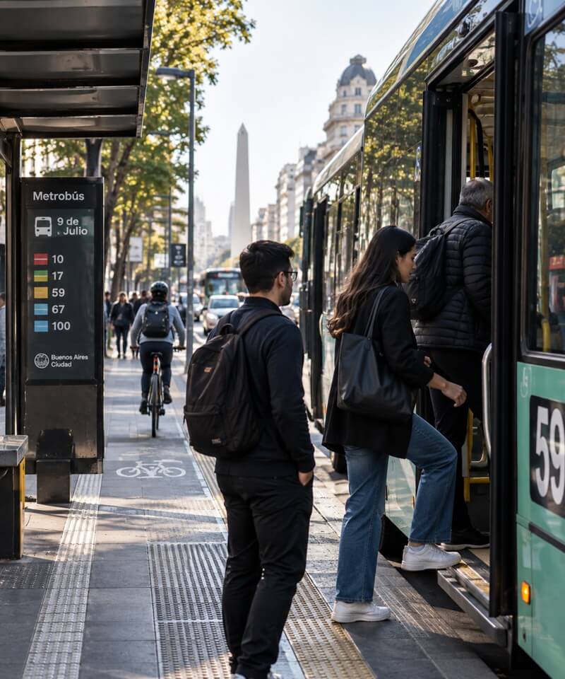
Last-mile delivery in Buenos Aires depends on “blue boxes”. Blue boxes are dedicated on-street spaces set aside for loading and unloading cargo. However, these spaces are often taken up by illegally parked private vehicles or held longer than needed. This forces delivery drivers to circle the block in search of somewhere to stop. This pilot introduces a reservation app connected to an Internet of Things (IoT) monitoring system, letting drivers check blue box availability and reserve a space in advance. Focused on three high-traffic commercial zones, the pilot addresses a challenge identified directly with local stakeholders aimed at making last-mile logistics faster and more predictable while cutting the unnecessary driving that comes with hunting for parking.
The tool is a free, user-friendly mobile app for drivers of medium and large logistics vehicles, paired with real-time sensor monitoring of blue box occupancy. By giving drivers visibility and certainty before they arrive, the pilot aims to reduce idling and circling time, ease congestion around loading zones, and improve compliance with how the spaces are meant to be used.
02
At a glance
Challenge
Blue boxes are frequently blocked, forcing drivers to circle for space and adding unnecessary emissions.
Solution
A reservation and monitoring system that lets drivers check availability and book a “blue box” in advance.
Technology
Mobile app for drivers with real-time IoT sensor monitoring of loading space availability.
Avoid
Avoid unnecessary round trips for parking and idling of logistics vehicles due to unavailable spaces, reducing GHG emissions.
Shift
Encourage a shift toward sustainable urban logistics practices by facilitating data-driven analysis of blue box use.
Improve
Improve operational efficiency by reducing idling and circling, and by optimising the monitoring and management of loading spaces with data-driven solutions.
03
Expectedoutcomes
Environmental
Reduced GHG emissions from decreased idling and circling time of logistics vehicles.
Social
Improved driver experience around parking, alongside training and inclusion of women in urban logistics roles.
Economic & Operational
Improved efficiency of last-mile delivery operations and greater availability of blue boxes for cargo operations.
Digital & Innovation
Adoption of the reservation and monitoring tools, supporting integrated digital logistics and mobility planning.
Governance / Institutional Frameworks
Strengthened evidence-based models for urban logistics policy and parking enforcement.
03
Aboutthe pilot
Data analysis for evidence-based public policy
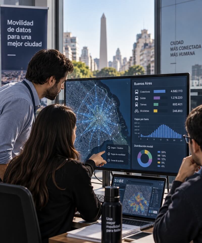
This pilot expands UrbanTrips, an existing open-source tool already tested in Buenos Aires, to analyse origin-destination and passenger mobility data drawn from SUBE and other sources. It builds daily travel chains for users, generates operational indicators such as occupancy, demand and distances travelled per line, and presents the results through tables, charts and interactive maps, addressing a need identified with national and city transport officials for stronger, evidence-based decision-making.
Alongside the data platform, the pilot rolls out a real-time vehicle-tracking system (GTFS-RT) on the city's electric bus fleet (eBUS and TramBus), pulling live GPS signals so passengers, city screens and platforms like Google Maps can show accurate arrival times. It will support better decisions on public transport planning, accessibility, service coverage, active mobility, gender-sensitive indicators and low-carbon transport policy.
02
At a glance
Challenge
Mobility data isn't fully utilised for public policy decisions, leaving planners without a real-time view of how people travel.
Solution
An expanded data platform generating origin-destination analysis and real-time transit information to guide transport planning.
Technology
UrbanTrips platform integrated with SUBE data, plus GTFS real-time tracking on the electric bus fleet.
Avoid
Avoid inefficient transport planning by providing evidence on how people actually travel, reducing unnecessary infrastructure and service costs.
Shift
Encourage a shift from private vehicles to public transport by using data insights to improve service reliability and rider confidence.
Improve
Improve public transport efficiency and accessibility by enabling data-driven decisions on routes, schedules and service gaps.
03
Expectedoutcomes
Environmental
Enhanced sustainable transport planning through origin-destination and real-time data, supporting interventions that reduce GHG emissions.
Social
Gender-disaggregated mobility data used to improve safety, accessibility and equitable access, alongside reduced wait times and insecurity perceptions at bus stops.
Economic & Operational
Improved transport planning and optimised resource allocation by identifying mobility gaps and service inefficiencies.
Digital & Innovation
An open-source data dashboard integrating SUBE and other sources, alongside real-time GTFS tracking for a selected electric bus route.
Governance / Institutional Frameworks
Strengthened institutional capacity through regular KPI-based reports and geospatial outputs, with governance models established for scale-up and replication.
Explore the Buenos Aires pilots
The Buenos Aires pilots are being implemented across key areas of the city to improve urban logistics, curb management and evidence-based mobility planning.
This map should help visitors explore where ACCESS is working and why each location matters. Toggle layers can show logistics activity, public transport corridors, curbside management areas and data-analysis geographies. Short tooltips should explain how each layer connects to emissions reduction, operational efficiency and inclusive mobility planning.
WHAT ACCESS WILL MEASURE
Measuring impact in Buenos Aires
The Buenos Aires pilots will generate evidence on how digital tools can improve urban mobility systems. Monitoring will focus on environmental, operational, social, gender, policy and governance results. All of this information will support the development of national and subnational policy shifts in Argentina.
GENDER & INCLUSION
Inclusive and gender-responsive mobility
Women in Argentina face persistent barriers across care responsibilities, safe and equitable mobility, workforce inclusion, and digital participation. ACCESS has the potential to address these challenges by advancing inclusive and gender-responsive solutions through digital innovation, stronger evidence for decision-making, and promoting training opportunities for women in the sector.
Each pilot includes tailored actions shaped together with local partners. In addition, the ACCESS teams are following the ACCESS Guidelines for Responsible and Inclusive Digitalisation in Transport and are aligning activities with the Gender Action Plan for Argentina and the safeguards for digitalisation in transport. These activities include:
- Strengthening technical skills and capacity-building opportunities for women in sustainable mobility and digitalization.
- Integrating inclusive design and gender-sensitive features into digital solutions.
- Incorporating gender-disaggregated data and exploring indicators for care-related mobility and the mobility needs of people with disabilities.
- Promote gender-responsive transport policies and planning tools.
From pilot to scale
Lessons beyond Buenos Aires
The Buenos Aires pilots are designed to generate lessons for other cities in Argentina and Latin America. ACCESS will use the results from Buenos Aires to support replication, capacity building and policy recommendations on transport digitalisation, sustainable logistics and inclusive mobility planning.
Resources and next steps
Explore resources, guidance and learning materials from the Buenos Aires pilots to support sustainable logistics, inclusive mobility and evidence-based transport planning.
Key statistics and insights from Buenos Aires.
Download city factsheetSummaries of the Buenos Aires pilot projects.
View pilot briefsEvaluation and results from pilot implementation.
View monitoring reportsResources supporting inclusive and gender-responsive mobility.
View gender resourcesGuidelines for responsible data management and digitalisation.
View data guidanceTraining materials, tools and lessons from ACCESS.
Explore learning resourcesPractical steps for scaling and replicating pilot projects.
View replication checklistTake the next step with ACCESS
The Buenos Aires pilots are designed to generate lessons for other cities in Argentina and Latin America. ACCESS will use the results from Buenos Aires to support replication, capacity building and policy recommendations on transport digitalisation, sustainable logistics and inclusive mobility planning.